Whitsunday Great Walk
The Whitsunday Great Walk meanders through the Conway State Forest and Conway National Park as it climbs up and down and all around the Conway Ranges of the Whitsundays. Beautiful views of the Whitsunday Islands and the townships of Airlie Beach and Shute Harbour are caught along the way.
The walk in its entirety is about 30km and climbs to a height a little over 400m above sea level. During the first day of the walk (Leaving from the Brandy Creek entrance) it is a mostly gentle downhill, wide and well established track. There is plenty of shade and even during the heat of the day, the walk is pleasant. There are 4 creeks to cross along the way and after heavy rain, these could be a challenge to cross so you should take care. Most of the time though, you can expect to get your feet wet as you walk across but nothing more. Arriving at the first campsite (Refuge Creek Camp) after about 8km is a pleasant experience. The campsite is a cleared area with small platforms for sitting, and the campsite has plenty of space as well. Very nearby is a track leading to Refuge Creek and that's a great place to cool after a pleasant couple of hours walking. Water is often available at this campsite, but it is tank water and may or may not be available for you. If not, try water from the creek, but treat it first to kill any bugs that might be present. National Parks also recommend you treat the tank water as well before drinking. There are no fires permitted for the entirety of the walk, but you can use small stoves like gas, liquid fuel and hexamine tablets to heat your well-earned dinner.
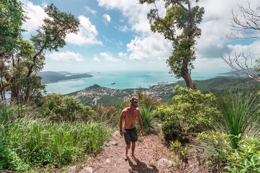
The next day, your walk (About 12km) ramps up a bit and becomes more difficult as you walk mostly up hills, quite steep at times, and find yourself at the top of Mount Hayward a couple of hours later. The track is narrower than the first day and you'll ford a few more creeks before you finally break out at the top of the ridges to make your way to a lookout with views over Shute Harbour and most of the Whitsunday Island Group. The views are limited, but truly amazing, giving you a real sense of the scale of the Whitsunday Islands. The walk to the Bloodwood Campground is about another hour or so and not as steep, but it does have its moments!
Bloodwood camp is a contrast with Refuge Creek Camp in that it is nestled amongst the rain forest rather than having any large cleared areas. Water is located about another 200m past the last campsites. There is a great lookout here with awesome views across Jubilee Pocket, the new marina and all the northern islands in the Whitsunday Island group.
About 3km after leaving Bloodwood camp, there is a final water tank (that may have water) before you undertake one of the steepest sections of the walk. This section takes you to the very top of the walk, but there are no lookouts established here and you will only catch glimpses along the way through the dense rain forest. The steep section though is thankfully short, so take your time and have a couple of breaks along the way. After this, you'll work your way along the ridgelines before starting a medium to steep (But long) descent into Airlie Beach. Along the way, you'll get glimpses of water views before finally dropping into Kara Crescent in Airlie Beach and a great view of the boats in the Marina at Airlie Beach. Although it is a tough walk at times, a fairly fit adult or child can manage it by taking their time.
To find out more about hikes around the Whitsundays, click here.